


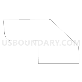
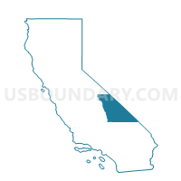
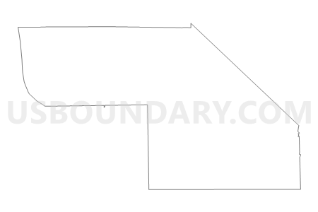
Voting District 50095, Inyo County, California
About
Outline
Summary
| Unique Area Identifier | 531139 |
| Name | Voting District 50095 |
| County | Inyo County |
| State | California |
| Area (square miles) | 1,334.91 |
| Land Area (square miles) | 1,329.86 |
| Water Area (square miles) | 5.05 |
| % of Land Area | 99.62 |
| % of Water Area | 0.38 |
| Latitude of the Internal Point | 36.54374900 |
| Longtitude of the Internal Point | -116.96385770 |
Maps


Graphs
Select a template below for downloading or customizing gragh for Voting District 50095, Inyo County, California


Neighbors
Neighoring Voting District (by Name) Neighboring Voting District on the Map
- Voting District 40066, Inyo County, CA
- Voting District 40075, Inyo County, CA
- Voting District 50090, Inyo County, CA
- Voting District 50110, Inyo County, CA
- Voting District 50126, Inyo County, CA
- AMARGOSA VALLEY PRECINCT 06, Nye County, NV
- BEATTY PRECINCT 01, Nye County, NV
Top 10 Neighboring County Subdivision (by Population) Neighboring County Subdivision on the Map
- Amargosa Valley CCD, Nye County, NV (1,456)
- Beatty CCD, Nye County, NV (1,032)
- Death Valley CCD, Inyo County, CA (765)
Top 10 Neighboring Place (by Population) Neighboring Place on the Map
Top 10 Neighboring Unified School District (by Population) Neighboring Unified School District on the Map
- Nye County School District, NV (43,946)
- Lone Pine Unified School District, CA (2,549)
- Death Valley Unified School District, CA (765)
- Owens Valley Unified School District, CA (677)